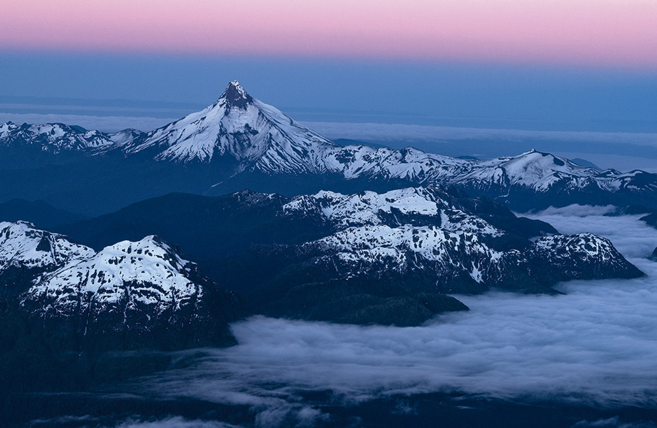
Chile is a country of mountains, so on International Mountain Day, we celebrate that 67% of our territory highlighting our imposing mountain range that accompanies almost all of our landscapes. Are you a mountaineer? Then Chile is your final destination: high peaks, snow-capped mountains and craters are some of the attractions that adventure and sport lovers will find here in the highest peaks of each of the regions of Chile, from north to south.
Arica and Parinacota
Parinacota Volcano (6,282 meters)
The Parinacota volcano - "place of parinas" in Aymara - is the highest mountain in the region and forms part of the Payachatas chain of snow-capped mountains inside the Lauca National Park (biosphere reserve). Legend has it that the Payachatas, volcanoes located in the Lauca National Park, are the tombs given by nature to an Inca princess and prince, which today bear the name of Parinacota and Pomerape. The most recent eruptive activity is estimated around the year 1800, consistent with what is suggested by the Aymara legends in the area. Due to its height and low technical difficulty, it is probably the most climbed mountain in the area.
Tarapacá
Sillajhuay (5,982 meters)
The Sillajhuay, which in the Aymara language means "devil's armchair", is a small mountain range of volcanic origin located on the Chilean-Bolivian border. It has several summits among which the Alto Toroni hill stands out, located a little further north. Considered a sacred mountain or "mallku" in the Andean culture, it reaches an altitude of almost 6000m, dominating all the hills of the sector, and marveling visitors with a small glacier tongue on its southeast face, considered the southernmost glacier discovered in the altiplano.
Antofagasta
Llullaillaco Volcano (6,739 meters)
The Llullaillaco volcano, which in the Aymara language means "hot water", is located between the Province of Salta and the Antofagasta Region, on the border between Argentina and Chile. In spite of being the third highest mountain in Chile and its beautiful surroundings with small streams that run between bofedales and coironales in the ravines from where you can see guanacos, donkeys and birds; it is very little visited due to the difficult access and the existence of minefields in the sector. At the present time there are two ascension routes through Chile: the northern route allows reaching 4600m by vehicle, while the southern route allows reaching 5000m. In both it is necessary to cross large snowfields with hard snow, so it is recommended to carry crampons and ice axe, and during the ascent it is possible to see guanacos, donkeys and the occasional bird.
Atacama
Ojos del Salado Volcano (6,891 meters)
Located in the third region of Chile - inside the city of Copiapó - and in the province of Catamarca on the Argentinean side, the Ojos del Salado volcano stands out as the most outstanding summit among the mountain peaks of the area, making it worthy of several records in Chile and the world: being the highest volcano in the world, the second highest summit in America, the highest mountain in the Chilean Andes and the second highest in the Argentinean Andes after Aconcagua (6959m).
Being located south of the Atacama Desert, in the middle of the South American Altiplano, in its surroundings it is possible to appreciate salt flats, sands, flamingos and colorful lagoons; accompanied by snow and glaciers that crown the summits of the most arid and desert area of the Andes.

Coquimbo
Nevados Olivares (6,216 meters)
The Nevado de Olivares, besides being the highest mountain in the Region of Coquimbo in Chile, is the fourth highest in the Province of San Juan in Argentina, after the Nevado Olivares Central or Majadita. It is a "seismic" rarely climbed due to the difficulty to access it and the lack of water in its possible camps.
The normal route through Argentina starts next to the route to Paso Aguas Negras at the entrance to the San Lorenzo creek at about 4100m of altitude, while the normal route through Chile starts after the La Laguna dam at about 3400m, which makes the approach longer than through Argentina. The latter, added to the dryness of the mountain on the Chilean side, means that the mountain receives very few visits from this side.
Valparaíso
Nevado Juncal (5,968 meters)
El Juncal is an enormous snow-capped mountain that occupies an important site in the central mountain range near Santiago. It is the point of communion of large glacier systems that spread from its four summits in different directions, boasting snows that are unparalleled among its neighbors. Few mountains, especially those located in the central Chilean Andes, have a northern slope as snowy and steep as Nevado Juncal and, therefore, it is a special case that has attracted the attention of glaciologists from around the world who have traveled to investigate it in detail.
Metropolitan
Tupungato Volcano (6,570 meters)
The Tupungato - "viewpoint of stars", "white dove", "tip of the roof", "high mountain", "the one that frightens and rejects", "the one that instills fear or respect", "hill where the river of gold is born", "observatory of the condors" are some of the interpretations for its name coming from the Huarpe, Quechua and Mapudungún languages-: is the highest mountain in the Andes Mountain Range south of Aconcagua and dominates the surroundings with its enormous size and representative cone, surpassing by many meters all neighboring peaks. This volcano is a serious challenge for mountaineers looking for high altitude experience; a high, isolated, technically simple "seismic", and as hard as Aconcagua.
Bernardo O'Higgins
Picos del Barroso (5,174 meters)
Probably many mountaineers who have climbed a mountain in the Cajón del Maipo area have been struck by the sight of a large, heavily glaciated massif to the south. It is the Picos del Barroso, a strange mountain very little visited in recent times, due to access restriction policies. In spite of being the highest mountain in the sector, it does not have a clearly identifiable summit, but rather it seems to be a great glacier mass almost flat in its upper part with four main summits: two completely within Chile, one in Argentina and another binational one.
Maule
Peteroa Volcano (4,113 meters)
On the border between Argentina and Chile, the Planchón-Peteroa-Azufre volcanic complex is one of the most attractive mountain phenomena in the central Andes. In its surroundings there are several glaciers, which give birth to important rivers. On the Chilean side, the Claro River, which joins the Teno River at Los Queñes, and part of the upper basin of the Colorado River. On the Argentinean side, the Valenzuela River, which later becomes the Grande River. The Peteroa is a flattened volcano of approximately 3600m, it is located between the Planchón volcano (located to the North) and Azufre (located to the South), both with heights that surpass that of the Peteroa. Today's mountaineer who reaches this summit will find this set of craters, instead of the classic volcanic cone that Peteroa once had and that its neighbor Azufre still has.
Ñuble
Nevados de Chillán (3,212 meters)
In the central area of the Andes of Chile, 70km southeast of the city of Chillán, this volcano is immersed in a rugged environment where you can see large moraines, rimayas, crevasses, glaciers, craters and parasitic cones, in addition to its two great neighbors: the New Volcano (3186m) and the Old Volcano (3122m). It has several glaciers that give rise to its name, the most characteristic being those that slope to the southeast and southwest. Today the southwest glacier is reduced to a small mass of ice that descends from the summit to 2500m approximately, towards the valley of Shangri La, where below is a huge volcanic slag heap in the middle of a beautiful native forest composed of lengas, quilas, copihues, coihues and oaks. Because it is the most accessible of the glaciers in the region, it is used as a school by climbers from Concepción, Chillán and others from the Eighth Region.

Biobío
Sierra Velluda (3,585 meters)
The Sierra Velluda is located inland from the city of Los Angeles (100 kms from the Panamerican Highway). Its summit is notorious, of singular height and dominates the surroundings, being visible from Victoria in the south to Chillán in the north. The hill presents numerous glaciers of certain consideration. On January 17, 1940, E. Fahrenkrog, K. Kroessig and H. Tilly made the first ascent to the main summit of the Sierra Velluda (north peak, 3585m) by the Canaleta Oeste route. In the account of their ascent Kroessig complains that they did not encounter the difficulties they expected for a mountain with the fame that the Sierra Velluda had at the time.
Araucania
Lanín Volcano (3,747 meters)
The Lanín, which means "dead rock" in Mapudungun, is to the southern mountain range what the Aconcagua is to the central mountain range: both surpass their neighbors by more than a thousand meters, and impose themselves on the horizon like no other. Some Argentine poets from Junín claim to have glimpsed both oceans from their extinct crater, when the skies were clearer. This fantastic fact has not yet been corroborated; however, the Lanín certainly dominates a radius exceeding 150 km.
The Mapuche tradition believed that at the top of the volcano dwelt perverse spirits that killed those who dared to climb it. On the other hand, Lanín, besides "dead rock", is the verb of the first person plural meaning "we sink" (in the ashes of the volcanoes or in the snow). It is not known of the last eruption of the volcano, but surely the volcano frightened many generations of Mapuches, in other times.
The Rivers
Villarrica Volcano (2,840 meters)
The original name of the volcano is Quitralpillán, which in Mapudungún means "abode of the ancestors with fire". The Villarrica is considered one of the most active volcanoes of the continent, highlighting its smoke from far away during the day. During clear nights, the fascinating reflection of the incandescent lava on its summit can be observed from great distances. There are some who claim that the volcano was climbed by the Mapuches several centuries ago (XVI century). However, this hypothesis is unlikely considering the profound religious importance of the volcano as the sacred abode of the ancestors; even today the Mapuche people respect the volcano and continue to dedicate rituals to it.
Today many tourists visit the crater of this volcano to observe the explosions of incandescent magma that occur at irregular intervals. During the winter it is possible to descend from the edge of the crater on skis or snowboards; the descent with the lake as a backdrop is amazing. The long-lived coigües and araucarias in the forests surrounding the volcano also attract attention. Only 18km separate the city of Pucón, the region's busiest tourist center, from the base of the volcano.

The Lakes
Cerro Tronador (3,491 meters)
The Tronador is certainly an impressive mountain. Its tremendous massif, covered by seven glaciers that spill down its slopes until they violently plunge off cliffs; its height, which makes it by far the highest peak in the surroundings, only surpassed by the Lanin, more than 100km to the north; its three summits of regal stamp; the gigantic crevasses that cross its glaciers and that are always a threat to the mountaineer; the spectacular environment in which it is located, surrounded by spectacular lakes and symmetrical volcanoes. All this undoubtedly makes the Tronador a difficult mountain to forget for anyone who has ever looked at it.
The Tronador is located in the interior of Lake Todos los Santos, on the border with Argentina. Of volcanic origin, it has three clearly distinguishable summits: the main summit, 3491m, which is a border, that is, it is a shared summit; the Chilean summit, 3320m, is in Chile; the Argentinean peak, 3200m approx; is in Argentina.

Aysén
Mount San Valentín (3,910 meters)
Patagonia is home to one of the most attractive terrains at an international level for the practice of exploratory mountaineering, as there are still many mountains awaiting their first ascent. An exception to this rule is the great Mount San Valentin, considered the highest peak of all the Patagonian Andes. San Valentín is located in the northern limits of Campo de Hielo Norte, and is surrounded to the north by the Circo glacier; to the east by the San Valentín glacier and the Cuerno de Plata mountain; to the west by the San Rafael glacier and the Pirámide mountain; and to the south by the Fiero mountain and the glacier extension of Campo de Hielo Norte.
Located in the XI region of Aysén del Capitán Carlos Ibáñez del Campo, within the Laguna de San Rafael National Park, Campo de Hielo Norte is a region of continental ice located completely in Chilean territory, whose surface reaches 4200km2 and a length from north to south of approximately 120km by 50km wide. It is bounded to the north by the Tranquilo, Bayo and Exploradores rivers; to the east and south by the General Carrera Lake and the course of the Baker River; while to the west it is bounded by the Pacific Ocean, between the Elefantes Seno, the San Rafael Lagoon, the Ofqui Isthmus and the Baker River delta.
Magellan
Lautaro Volcano (3,623 meters)
With its more than 3500 meters of altitude, the Lautaro volcano is not only the highest summit of the Magallanes Region, but of the entire Southern Ice Field, undoubtedly, a giant of Patagonia. This active volcano is part of the Pío XI range (also called Lautaro range). It is located in the Bernardo O'Higgins National Park, northwest of the Cuatro Glaciares plateau (from where the Viedma, Pío XI and O'Higgins glaciers descend), northeast of the Caupolicán plateau and south of the Todas las Madres plateau. It had its last eruption in 1979 and has abundant ash deposits on the surrounding glaciers (O'Higgins and Chico), so it is considered an active volcano.
For more information: AndesHandbook


