Arica and Parinacota
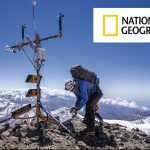
Parinacota Volcano (6,282 meters)
The Parinacota volcano - "place of parinas" in Aymara - is the highest mountain in the region and is part of the Payachatas chain of snow-capped mountains, inside the Lauca National Park (biosphere reserve). Legend has it that the Payachatas, volcanoes located in the Lauca National Park, are the tombs given by nature to an Inca princess and prince, which today bear the name of Parinacota and Pomerape.
The most recent eruptive activity is estimated around the year 1800, consistent with what is suggested by the Aymara legends in the area. Due to its height and low technical difficulty, it is probably the most climbed mountain in the area.
Tarapacá
Sillajhuay (5,982 meters)
The Sillajhuay, which in the Aymara language means "devil's armchair", is a small mountain range of volcanic origin located on the Chilean-Bolivian border. It has several summits among which the Alto Toroni hill stands out, located a little further north. Considered a sacred mountain or "mallku" in the Andean culture, it reaches an altitude of almost 6000m, dominating all the hills of the sector, and marveling visitors with a small glacier tongue on its southeast face, considered the southernmost glacier discovered in the altiplano.
Antofagasta
Llullaillaco Volcano (6,739 meters)
The Llullaillaco volcano, which in the Aymara language means "hot water", is located between the Province of Salta and the Antofagasta Region, on the border between Argentina and Chile. In spite of being the third highest mountain in Chile and of its beautiful surroundings, with small streams that run between bofedales and coironales in the ravines, from where guanacos, donkeys and birds can be sighted; it is very little visited due to the difficult access and the existence of mined fields.
There are currently two ascent routes in Chile: the northern route allows you to reach 4600m by vehicle, while the southern route allows you to reach about 5000m.
In the sector. At present there are two ascent routes in Chile: the northern route allows reaching 4600m by vehicle, while the southern route allows reaching 5000m. In both it is necessary to cross large snowfields with hard snow, so it is recommended to carry crampons and ice axe, and during the ascent it is possible to see guanacos, donkeys and the occasional bird.
Atacama
Ojos del Salado Volcano (6,891 meters)
Located in the third region of Chile - inside the city of Copiapó - and in the province of Catamarca on the Argentinean side, the Ojos del Salado volcano stands out as the most outstanding summit among the highest mountain peaks in the area, making it worthy of several records in Chile and the world: being the highest volcano in the world, the second highest summit in America, the highest mountain in Chile and the second highest in the Argentinean Andes after the Aconcagua (6959m).
Being located south of the Atacama Desert, in the middle of the so-called South American Altiplano, in its surroundings it is possible to appreciate salt flats, sands, flamingos and colorful lagoons; accompanied by snow and glaciers that crown the summits of the most arid and desert area of the Andes.

Coquimbo
Nevados Olivares (6.216 meters)
The Nevado de Olivares, besides being the highest mountain in the Coquimbo Region in Chile, is the fourth highest in the Province of San Juan in Argentina, after the Nevado Olivares Central or Majadita. It is a "seismic" rarely climbed due to the difficulty to access it and the lack of water in its possible campsites.
The normal route through Argentina starts next to the route to Paso Aguas Negras at the entrance to the San Lorenzo creek at about 4100m altitude, while the normal route through Chile starts after the La Laguna dam at about 3400m, which makes the approach longer than through Argentina. The latter, added to the dryness of the mountain on the Chilean side, means that the mountain receives very few visits from this side.
Valparaíso
Nevado Juncal (5,968 meters)
El Juncal is an enormous snow-capped mountain that occupies an important site in the central Andes mountain range near Santiago. It is the point of communion of large glacier systems that spread from its four summits in different directions, boasting snows that are unparalleled among its neighbors. Few mountains, especially those located in the central Chilean Andes, have a northern slope as snowy and steep as Nevado Juncal and, therefore, it is a special case that has attracted the attention of glaciologists from around the world who have traveled to investigate it in detail.
Metropolitana
Tupungato Volcano (6,570 meters)
The Tupungato - "viewpoint of stars", "white dove", "tip of the roof", "high mountain", "the one that frightens and rejects", "the one that instills fear or respect", "hill where the river of gold is born", "observatory of the condors" are some of the interpretations for its name coming from the Huarpe, Quechua and Mapudungún languages-: is the highest mountain in the Andes Mountain Range south of Aconcagua and dominates the surroundings with its enormous size and representative cone, surpassing by many meters all neighboring peaks.
This volcano is a serious challenge for mountaineers looking for high altitude experience; a high, isolated, technically simple "seismic", and as hard as Aconcagua.
Bernardo O'Higgins
Picos del Barroso (5,174 meters)
Probably, many mountaineers who have climbed a mountain in the area of the Maipo Canyon have been struck by a large, heavily glaciated massif when looking to the south. It is the Picos del Barroso, a strange mountain that has been rarely visited in recent times, due to access restriction policies.
Despite being the highest mountain in the sector, it does not have a clearly identifiable summit, but rather appears to be a large, almost flat glacier mass in its upper part with four main vulcanic and Andean summits: two completely within Chile, one in Argentina and another binational one.
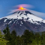
MauleVolcano
Peteroa (4,113 meters)
On the border between Argentina and Chile, the Planchón-Peteroa-Azufre volcanic complex is one of the most attractive mountain phenomena in the central Andes. In its surroundings there are several glaciers, which give birth to important rivers. On the Chilean side, the Claro River, which joins the Teno River at Los Queñes, and apart from the upper basin of the Colorado River. On the Argentinean side, the Valenzuela River, which later becomes the Grande River.
The Peteroa, a flattened volcano of approximately 3600m, is located between the volcanoes Planchón (located to the north) and Azufre (located to the south), both with heights that surpass that of the Peteroa. Today's mountaineer who reaches this summit will find this set of craters, instead of the classic volcanic cone that Peteroa once had and that its neighbor Azufre still has.
Ñuble
Nevados de Chillán (3,212 meters)
In the central area of the Andes of Chile, 70km southeast of the city of Chillán, this volcano is immersed in a rugged environment where you can see large moraines, rimayas, crevasses, glaciers, craters and parasitic cones, in addition to its two great neighbors: the New Volcano (3186m) and the Old Volcano (3122m). It has several glaciers that give rise to its name, the most characteristic being those that slope to the southeast and southwest.
Today the southwest glacier is reduced to a small mass of ice that descends from the summit to 2500m approximately, towards the valley of Shangri La, where below is a huge volcanic slag heap in the middle of a beautiful native forest composed of lenga, quilas, copihues, coihues and oaks. Because it is the most accessible of the glaciers in the region, it is used as a school by climbers from Concepción, Chillán and others from the Eighth Region.